Prevent risk.
Reward behavior.
Retain customers.
Keep your customers safe and up to date, and provide them with the most relevant service.
InfographicTELEMATICS SOLUTIONS
BEST PRACTICES
"A winning partnership which helped to position ourselves internationally."

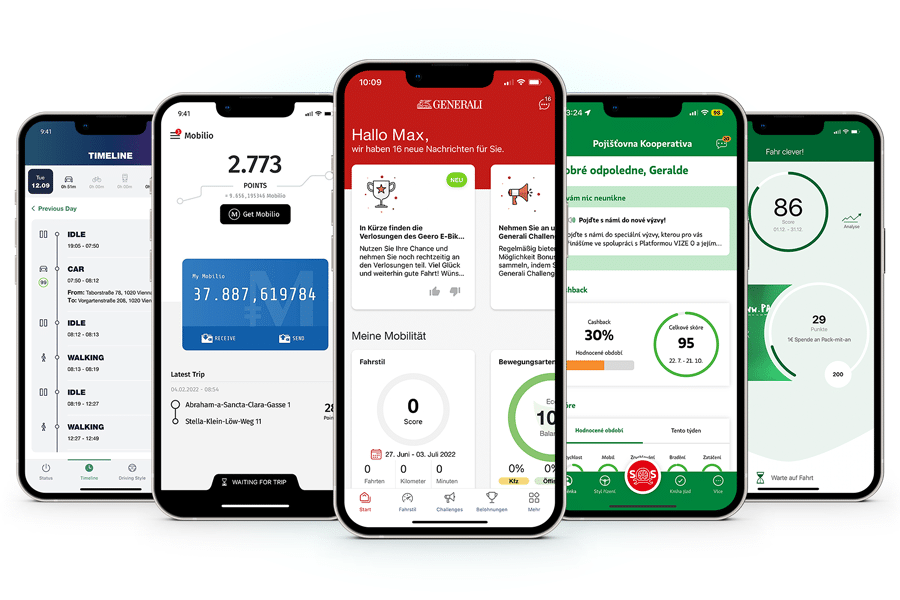
"Immediate help at the push of a button - The Generali Emergency App."
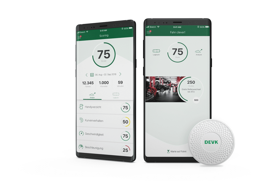
"Users of the "FahrClever!" App are delighted to be rewarded for cautious driving!"

"Awarded for outstanding achievements and industry leadership."
"Passion, competence and commitment. An invaluable partnership!"
"Dolphin provides innovative technology to increase road safety."

"The Drive+ app increases road safety. Our customers love it!"

"Next generation insurance telematics with microservices" Case Study

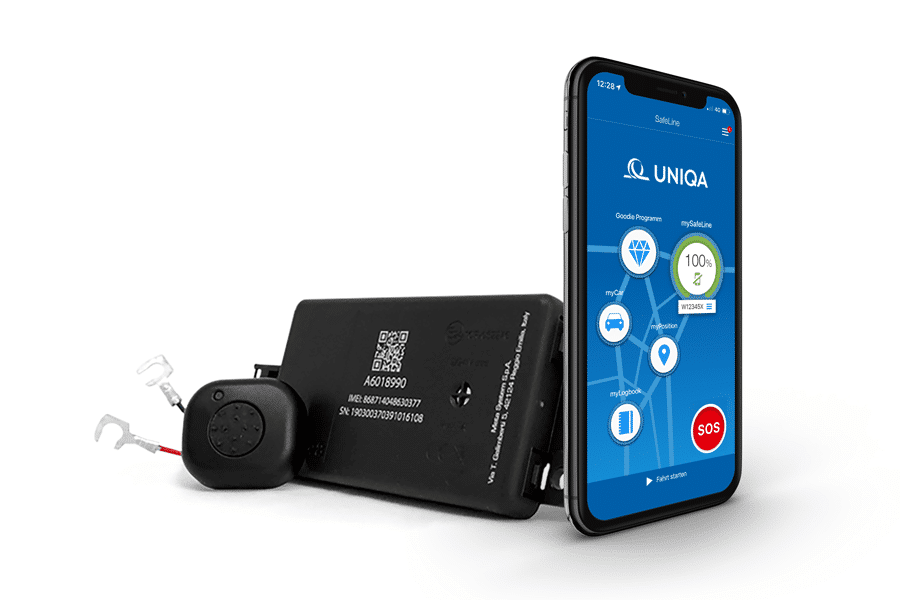
"SafeLine is a unique product that has attracted more than 80,000 customers."


DOLPHIN IS A
FULL SERVICE AGENCY
Consulting

Strategy

Implementation

Analytics

Operations

Marketing

COMPANY


With solutions from Dolphin Technologies insurers evolve from writing policies and handling claims to become valuable partners in the life of their customers. Insurance companies can support people in real time in case of emergency, reward good behaviour, warn in time against potential risk, provide the right information at the right time, and support with smart solutions. Dolphin designs, develops, implements and operates scalable platforms, products, and services in the field of Telematics, Mobility, and Marketing Automation. Dolphin is an Austrian company, founded in 2001 and is repeatedly honoured nationally and internationally for excellence in innovation.

Gerald Aichholzer
Product Development-
Andreas Kössl
CCO -
Harald Trautsch
Co-Founder & CEO -
Thomas Pöschl
Co-Founder & COO -
Emanuel Altmann
Senior Development -
Georg Aschenfeld
Product Owner Implementation -
Oleksandr Baskakov
React Native Development 
Robert Beisteiner
CISO - IT / Operations-
Mariya Belozyorova
Customer and Partner Manager -
Petra Bilikova
Scrum Master -
Sabine Binder-Blaha
Office Administration -
Annina Breitenecker
Graphic Design/UI/UX -
Denys Busiak
Quality Management -
Lukas Eichhorn
Quality Management -
Ersin Ergül
Product Owner SDK -
Dagmar Ilisson
Sales -
Emir Kazybaev
Data Engineer -
Lukas Kilian
Development -
Wolfgang Kilian-Löffler
Senior Account Management -
Florian Knoll
Android Development -
Bella Kocsis
Cloud Engineering -
Mirza Likic
React Native Development -
Alexandra Linecker
Quality Management -
Caroline Mayrhofer
Scrum Master -
Bence Laszlo Mindszenti
Quality Management -
Joao Victor Miranda
Data Science -
Markus Mühlbacher
Lead Backend Development -
Andrea Prosche
Customer Care -
Katharina Sallinger
Data Science -
Alena Santalainen
Customer & Market Management -
Victoria Scharf
Office Administration -
Peter Schüller
Data Science -
Demyan Shcheglov
Senior Development -
Pavlo Simakovych
Quality Management -
Dominik Stelzig
Content & Marketing -
Clemens Unterkofler
iOS Development -
Patrick Wohlfart
Installer Management / Sales